FLOOD
HAZARD MAP
by
Antonio C. Antonio
September
23, 2013
This
article is about the simple but practical application of Geographic Information
Systems (GIS).
As I
write this, Typhoon Odette has been pouring an abnormally heavy volume of rain
on Metro Manila. Television footages and radio reportage carry nothing
but news and footages of the many flooded areas in the metropolis together with
the sacrifices and inconveniences people have to go through (and, sometimes,
wade through) to reach their respective destinations.
Most of
the people presently residing in Metro Manila are migrants from other
provinces. I was born in Tarlac City, had my primary education there but
migrated to the Big City for my secondary and college education. I met my
wife during my college days and after graduation and having our first jobs, we
decided to tie the knot and migrate back to Tarlac City. Later, as two of
our children were already I college (UP), we found the need to build a house in
Metro Manila… in Parañaque City where the family of my wife lives. Still
later, we decided to migrate back to Metro Manila if only to be with our
children everyday.
Like
most couples, we all dream of building homes for our children… our
family. Oftentimes, the reasons where we build these abodes vary --- from
affordability and financial capacity to proximity to our day-to-day
destinations, etc. --- but, most likely, NOT for geo-hazard reasons.
Personally, as I’ve already mentioned, the only consideration for my wife and I
was: “it’s where my wife’s family live.” But now that I’m getting wind of
new knowledge about environmental matters, things have started to become more
processed for me. I’m more deliberate with the use of GIS information
too… and I’m glad that I, even unconsciously then, chose a good location to
build our house (north eastern part of Parañaque City).
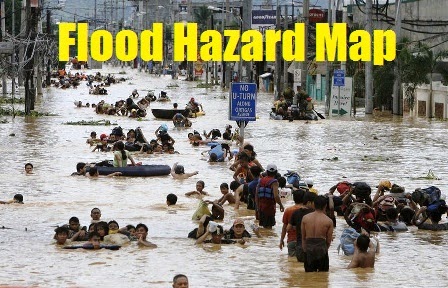
A quick
look at a Flood Hazard Map of Metro Manila would reveal the flood-prone areas
in the metropolis and the degree of risk some areas present. There are
several links in the Internet where GIS maps on flood-prone areas can be
viewed. Geospatial information is very
important in our lives. Flood Hazard
Maps could
be used for other practical applications such as (to name a few):
1. Processing decisions
to purchase a property and build a house;
2. Identifying sites to
establish a network for a (food, goods and services) distribution business;
3. Suggesting schools
where (your) children could go;
4. Suggesting business
districts where (your) children could look for employment; or even,
5. Mapping out routes
to take after a long and heavy downpour.
Other GIS maps and
accompanying data will definitely have more technical use and influence in
making more complex decision than the ones listed above.
Just my little
thoughts…
REFERENCES:
No comments:
Post a Comment